Newer Entries   

08/07/08 - Return To The Lighthouse

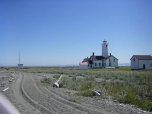
There have been some good tides at Dungeness Spit lately, so we wandered out to sea dryshod. The going was fairly easy, so we walked and walked, and before were knew it we were approaching the light house. The Dungeness Spit lighthouse hike is always a bit dreamy, but we were well rewarded with eagles, seals, gulls, terns and sea and sand.

Near the lighthouse we heard the gulls in an uproar. There was a cloud of hundreds flocking about. Then we saw the cause of this commotion. Two young bald eagles were being mobbed with gulls flying low over them and trying to force them from the sky. It wasn't exactly a concerted action, but it was effective. The young eagles were driven east.

Then the skies quieted. We walked onward to visit the lighthouse and pay a call on the seals who were not far off the spit near the lighthouse walkway. As we noted earlier, the Dungeness Spit lighthouse hike is always a bit dreamy.


Keywords: dungeness, dungeness spit, tides


07/09/08 - Second Beach: To The Seastack

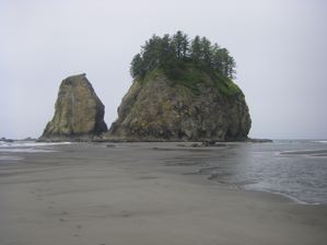
We've been visiting Second Beach for a number of years now, so we've been tantalized by the big seastack that lurks offshore just a bit south of the trailhead inland. Since we usually visit Second Beach at low tide, it often seems as if we could just walk right out to this seastack. Of course, every time we have approached we have found a channel of water blocking us. Sometimes it is fairly wide, but other times we are thwarted by a mere ten feet of choppy water of uncertain depth and current.

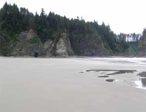
This July 9th was different. This time no confounding body of water appeared as we approached the seastack. Yes, the sand was wet, but we were able to approach the base of the seastack dryshod. The low tide was 0.8 feet, but we had been to Second Beach with lower tides. It took a combination of low tide and sand flow to create the miraculous sandbar we traversed.

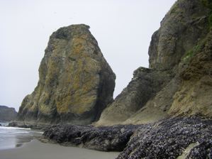
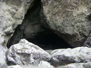
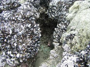
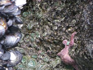
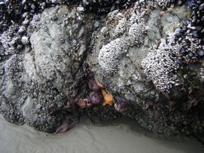
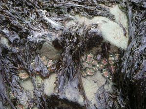
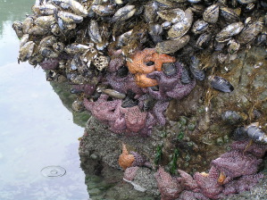
The base of the seastack was a jewel box of mussles and barnicles and lesser shells, here and there decorated with dazzling star fish. There were little caves, some worn into the stone and plain, others decorated like the seastack base. We made our way around the seastack, away from the beach. By carefully timing the waves we made it to the small beach between the large landward seastack and the smaller seastack behind it. We explored a bit, admiring our own adventurousness, our good fortune, and the wonderful scenery.

Not ones to press our luck, we made our way back after a brief sojourn, and explored the beachward face of the seastack. We have seen people climbing seastacks, and we considered climbing this one, but we Kalebergs have more the grace of gazebos than gazelles, so we settled for a sea level tour.

Our return to the beach along the sandbar was straightforward. This is just as well. We always like to be able to retrace our steps. We then explored Second Beach to the south, wandering about the Pirate Cave and gawking at anemones in the various tidepools. When we returned to the sandbar that led to the seastack the tide had risen. A fair bit of the sandbar was already submerged. We had seized our opportunity. Time and tide, we knew, wait for no man.


Our miraculous sandbar

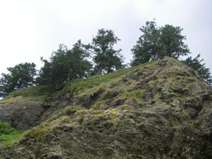
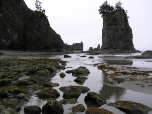
Seastacks are each a little world, isolated from our own. High above us grow forests, grasses, vines and, so we have been told, wild strawberries.

Our treacherous passage to the seaward seastack showing the mosaic of shells lining the base of the seastack.

A mysterious cave

A decorated cave

The surface is studded with shells and adorned with starfish.

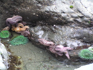
More starfish waiting out the tide

Keywords: beaches, second beach, tides


Low tide, but the beach is rocky.

06/24/08 - Good Hiking Tides at Dungeness Spit

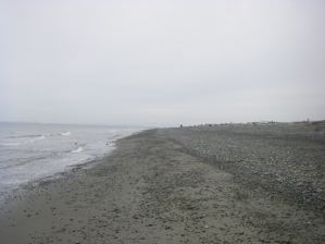
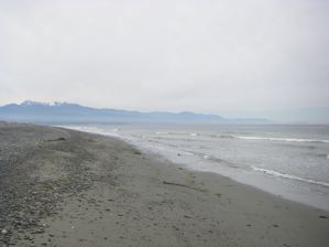
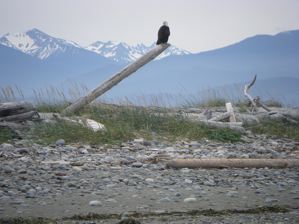
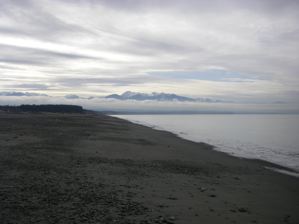
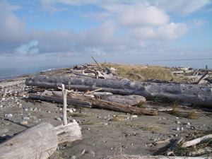
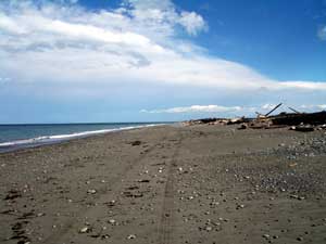
There have been some good hiking tides at Dungeness Spit lately. Yesterday, there was a -0.6 foot tide around one o'clock, so there was lots of beach to walk on. Check our tide tables, or our little notice on the left banner of this page, to find some other good tides in the near future. We have to be honest and report that the beach, while broad, was a bit rocky, with lots of small stones that kept us hopping. Still, we made it pretty far down, and we'll try for the lighthouse later this season.

Looking back at the mountains.

Dungeness Spit is more than just seagulls.

Keywords: dungeness spit, tides, birds


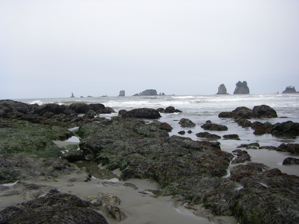
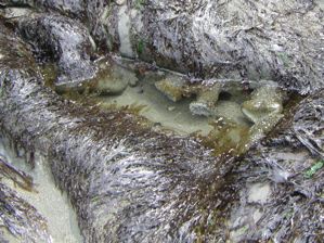
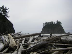
Tide pools and seastacks

05/15/08 - Signs Of Spring At Second Beach

There have been some fairly good tides at Second Beach recently, so we made a point to get out there. Second Beach is reached by a 3/4 mile trail through the coastal rain forest, and as we started down the "staircase" we could see that the tides were low.

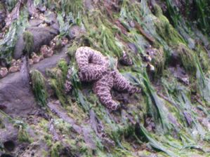
We clambered over this year's greatly increased pile of driftwood and made our way south to the "treasure cave" and climbed around some of the tidepools. There were a good number of anemones lurking where they could, and a few starfish waiting out the low tide.

The beach itself was broad and flat with the big breakers well out from the shore. The little river towards the south end of the beach had a good flow, so we had to cross it up near the bluffs. For us, it was a challenge, but most people can gambol from small stone to small stone with greater skill and less drama than we.


A starfish, one of many

Sea anemones

These are little sea anemones

O'er the ramparts we clambered ...

Keywords: second beach, tides


02/29/08 - Dungeness Spit Is For The Birds

We've been getting some good tides at Dungeness Spit, so we decided to do a bit of exploring. The tide was low and there was a lot of sand on the beach, so it was easy going. The view of the mountains was stupendous as you can see in the picture to the right.

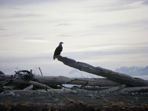
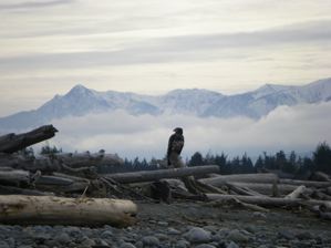
There were two bald eagles, maybe a dozen yards apart, perched on the driftwood on the high ground of the spit. The older eagle took off shortly after we started taking pictures, but the young eagle stood his or her ground.


The mature eagle

The kid
The sea was full of ducks and duck like birds including mergansers, loons, eiders, and cormorants. They're a bit hard to photograph since they tend to dive when they hear your camera focus. Still, they're fun to watch.

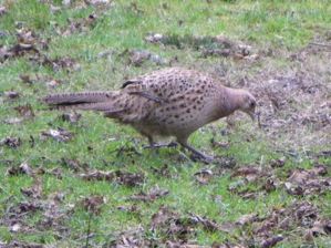
We also ran into this little fellow on the right. We aren't sure whether this is pheasant season or not, but this guy was hiding out in the refuge.


Another kind of bird

Keywords: birds, dungeness, dungeness spit, tides


01/08/08 - New Software - Sunrise, Sunset and iCal

For the past few years we've been using TideCal to compute good times and tides for hiking the beaches of the North Olympic Peninsula. If you look at the left hand sidebar on this page, you'll see that we use TideCal to predict upcoming hiking tides.

Apparently, a number of people like using iCal, the Macintosh calendar program, but it is sometimes hard to find the calendar you want. TideCal will make a hiker's tidal calendar, while other sites provide calendars with holidays, sporting events, historical birthdays and other such wonders. Now there is an iCal calendar generator for people who just want to know when the sun will rise and set. We call it Sunrise Sunset.

In the traditional of fine Kaleberg Kludges, it requires that you know your latitude and longitude (try getting a map bookmark from Google Maps), your time zone offset, and if you aren't in the US, when daylight saving time starts and ends. We make no warrantees or representations, just software.

Keywords: beaches, software, tides, historical


There isn't much beach, but what there is is choice.

11/26/07 - Dungeness Spit

There aren't any good high tides for hiking the Dungeness Spit until January, but the spit is still passable, even at fairly high tides (e.g. 8 feet or so). The going is rocky, with lots of rounded stones, and that makes it more tiring. Still, there is the strait, the islands and the sky, not to mention the wonderful mountain views.

Keywords: dungeness spit, tides


05/01/07 - Eagle Watching at Dungeness Spit

We took advantage of the morning low tide to explore the Dungeness Spit. It was a real low tide, with lots of beach, so we were able to walk out to the two mile marker and back mostly on nicely compacted sand.

In the winter, the tides tend to be high, so most hiking is done up at the high end of the beach near the piles of driftwood that collect there. In the warmer months, the tides tend to be lower, so we hike down towards the water, and driftwood is well up the beach.

That means that it's easy to get hypnotized by the sand and restless water, and not notice any eagles perching on the driftwood above. This time, we looked up, and there's a photo of the bald eagle we spotted on the left.

Keywords: birds, dungeness spit, dungeness, tides, winter


04/10/06 - New Tide Tables for Hikers

We've updated the tide tables for Cape Alava, La Push (Mora and Third Beach) and for the Dungeness Spit. We're trying out a new display format with less irrelevant cruft, and the good hiking days marked out in green.


Keywords: tides, cape alava, la push, dungeness spit, dungeness


03/05/06 - Dungeness Spit: It's Spring and the Low Tides Are Back

We were back at the Dungeness Spit recently and we saw something we haven't been seeing much this winter. The beach is back. Low tides are happening during the daylight hours again, and they are real low tides, not the little winter dips.

There are some good tides coming up on March 21st and 22nd, and then from April 1st to April 4th, which is especially nice since that includes the weekend. In fact, the weekends of the 1st, 15th and 29th of April are all good Dungeness Spit hiking days. For more, check out the tide tables or, if you are a Mac user, our Dungeness good tides iCal calendar.

Dungeness Spit at low tide

Keywords: dungeness spit, tides, software, dungeness, winter


Dungeness Spit - Winter High Tide

12/01/05 - Winter High Tide on the Dungeness Spit

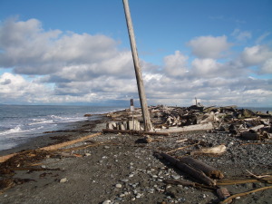
Whenever we mention hiking the Dungeness Spit, we always mention checking the tides. The winter high tides can be a real problem since the sun, earth and moon are so aligned that low tides in daylight are often drowned out by the primary winter tidal components, and at best reveal little of the beach. While a summer low tide provides a broad stretch of sand for walking, the winter presents more obstacles.

The picture on the left was taken at the 1/2 mile stake that is the last point on the spit for jogging. We walked out, and we walked out carefully. There was not much beach, and what there was was covered with rocks, logs, kelp and gravel. It was not easy going, and we turned shortly after this picture was taken. Click on it for a better look at the obstacle course, though we have to admit, it is a pretty picture.

According to our tide calculations, we guess that the next good hiking will be in early February 2006, though the trail will be rocky. The sand gets washed out in the winter, so the trail will be rough going. As spring comes in, the sand returns, but it is still worth checking the tides.

Keywords: dungeness spit, winter, tides, dungeness, spring


Sea Star at Second Beach

08/15/05 - Sea Stars

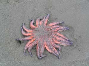
We often see starfish at Second Beach, particularly at low tide, but on our last visit we saw several stranded sea stars. You can tell they are echinoderms, related to the starfish and sea urchins, because they have five fold body symmetry. In fact, they look a lot like starfish, except they have 20 legs, rather than just five.

We've updated our tide tables for La Push, which is right near, and has almost the same tide schedule as, Second Beach. You can even download an iCal calendar to set up a trip at low tide so you can explore the tide pools and caves more easily.

Keywords: second beach, animals, fish, tides


TideCal Software

08/05/05 - TideCal - Tides for iCal

We often like to hike out the lighthouse at Dungeness Spit or take the Cape Alava - Sandy Point hike out near the northwest corner. These hikes take you a long way along the water in the Strait of San Juan de Fuca or along the Pacific, and while they are always wonderful hikes, they are best done when the tide is low and the sun is in the sky. Sometimes we check the tide tables to figure out when to go hiking, but sometimes we forget to check the tide tables, and we don't get to some of our favorite beaches.

Now, Kaleberg Symbionts has a new software solution to this problem. It's a simple program called TideCal for Macintosh users that lets you generate an iCal calendar file with just the tides you want. We want low tides, between noon and 3PM, so we can hike and get back in time for dinner. In general, tides under 3 feet are best, so we've put those tides on our calendar. Maybe we won't take advantage of one particular tide, but now we won't miss out just because we forgot to check the tide tables.

Keywords: software, tides, beaches, cape alava, dungeness


The Cave at Second Beach

07/01/05 - Solstice Tides

Thanks to the solstice, there have been some very low tides out at the West End beaches. This includes our favorite beach, Second Beach. At the south end of the beach there is a small cave that you usually cannot even get to at high tide. At low tide, the entrance is accessible from the beach. We went on a day with a particularly low tide, as you can see on the left, with only 0.8 feet of water. (If you want to plan your own low tide visit, check out our Tide Finder program, or our tide table for La Push).

Aside from being able to explore various caves, the low tide also brought up a lot of starfish. You can see them bunched up near the waterline on a mussel rock. We have never seen so many starfish stacked together like plastic toys. We could also see a lot more anemones, and not just the dull sand covered ones, but lovely blue-green ones, in the shallow tidal water. We only saw one eagle, but we were quite impressed with Second Beach nevertheless.
Seastacks at Second BeachHuge Number of StarfishBlue Anemones

Keywords: tides, second beach, beaches, la push, software


06/01/05 - Tide Finder for Finding Good Tides

While there are many programs for producing tide tables, there do not seem to be any programs for finding a suitable tide. For example, if you want a low tide during the day for exploring Cape Alava or walking the Dungeness Spit, you have to wade through listings of high and low tides. Tide Finder program is based on FlaterCo's XTide 2.6 package, and provides a Mac OS X friendly user interface for specifying a tide search. You specify a tide reporting station, a range of dates, a desired range of times and the desired tides, high or low. It gives you a hit list, a calendar and a tide graph.

Keywords: software, tides, beaches, science, cape alava, dungeness spit, second beach, dungeness


Dungeness Lighthouse

08/09/04 - To The Lighthouse

Last week we took a walk on the Dungeness Spit which is an unusual sand formation jutting out from the North Olympic Peninsula into the Strait of San Juan de Fuca. It is basically a sandbar shaped by the prevailing current from the west meeting the silty flow of the Dungeness River. The hike is about five miles each way, from the parking lot to the lighthouse and back, 4.5 miles of which are along the sand bar. You often see seals, cormorants, loons, and other wildlife, along with the sea traffic along the strait. There are excellent views of the Olympic Mountains and Vancouver Island, and a great sense of isolation being both so close to short and so cut off from it and surrounded almost completely by water.


On a cloudy day, the driftwood forest and the sky seem to be the same color. We tend to try and walk close to the water, so we can smell the sea and watch for washed up kelp and shells. The footing is also better closer to the see, since the wet sand holds one's weight better, and sand is easier to walk on than the lumpy, polished rocks that are deposited by the tide. The less determined hikers drop out by the one mile marker, which is next to the remains of a beached dinghy perched with the driftwood well above the sea. The bluffs vanish behind one as the spit curves between mile posts two and three. Then come the sandy tide pools stranded by the sand bars. By mile four, you often find a pod of seals who seem to hang around out towards the lighthouse.

It rained on our last trip, but the real challenges are the rocks and sand. You can wear a raincoat and broad brimmed hat, but the trick is to find the right low tide. Since our last trip, we've put together a little driver for finding tides using the XTide program. It is a really dinky little program, and in retrospect it seems kind of obvious. You might want to check it out before your next littoral adventure.

Keywords: dungeness spit, trails, dungeness, tides


Newer Entries