Sometimes you find amazing stuff on the web. For example, did you know that Washington State has a set of aerial pictures taken along the coast in 1994 available online. There's a guy taking photos along the California coast in his helicopter, and he's gotten sued by the likes of Barbara Streisand, but Washington has a different kind of coastline, or at least a different kind of coastal resident. We started poking around with Department of Ecology's Shoreline Aerial Photos while looking for an aerial photograph of Port Angeles. What we found was wonderful.
For example, we often hike along the Dungeness Spit. This is a marvelous piece of land built by the interaction of the Dungeness River and the Strait of San Juan de Fuca. It is a spit of sand, five miles longs, that has been deposited in an arc and takes one out into the strait, over a mile from shore. You can read more about the Kaleberg hike, and you can check the tides with our Dungeness tide page, but on this page you will find a link to a really wide picture of the spit built from ten or so of the images from the Department of Ecology's database.
The spit is a long narrow strip of land, as you can see below:
The composite image is 5910 by 448 pixels, and we've filled in a few bits along the edges with background cruft since the original imagery doesn't provide quite all the bits we need. If you'd like to trace a hike along the Dungeness Spit with the original imagery, click here. Click on the image above for a larger view of the composite.
The spit changes a bit from year to year. If nothing else, you'll notice changes in the driftwood from season to season, and the walking surface is sometimes sandy and sometimes rocky. If you take the hike, you'll want to go at low tide, so check out our tide tables, or search around for better ones. If you use a Macintosh, we have an iCal calendar you can download with some of the better days for hiking. These are recommended days, obviously you'll have to make your own judgment. It is a five mile walk, each way.
Once we get started, it's hard to stop. Here is another composite of one of our favorite Kaleberg hikes, Second Beach. Right now, in October 2005, Second Beach is closed as a result of a dispute between the Quillayute tribe and the federal government. The tribe would really like to have someplace to evacuate to in the event of a tsunami, but the originally intended refuge is currently zoned as wilderness. A compromise involving a land swap is in the works, and we hope it comes through. The trailhead for the Second Beach hike is on tribal land.
Here is a small view of Second Beach as seen from the air:
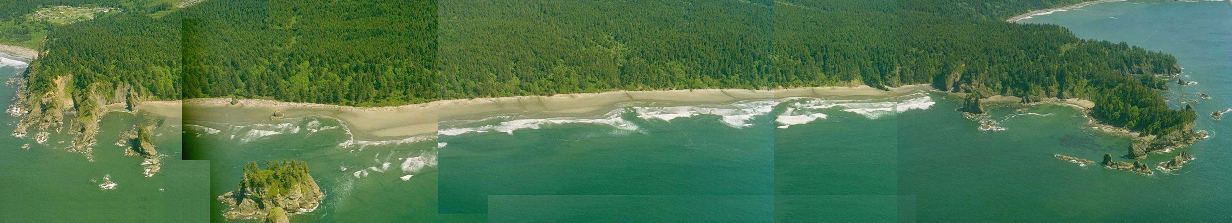
The overall image is 3916 x 710 pixels. For more information on the Kaleberg hike, click here. For information on the tides, click here.