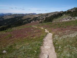
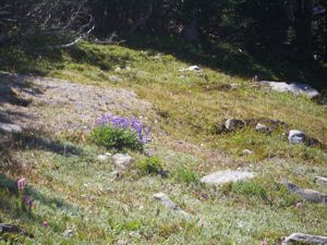
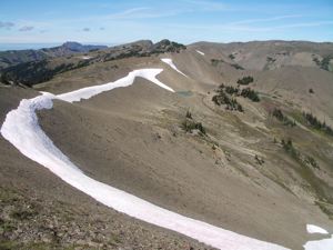
For more on Obstruction Point, see our Obstruction Point Trail web page.
Newer Entries   

10/14/07 - Obstruction Point Panoramas

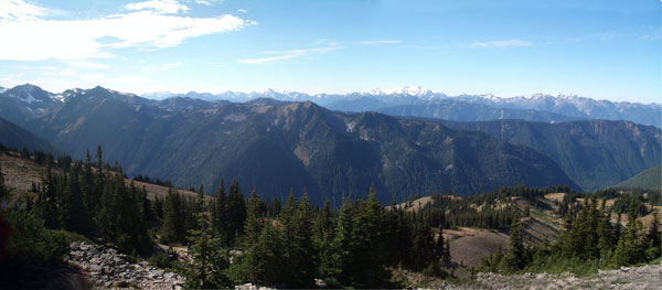
Obstruction Point Road was open again so we shot out for a last peek at the high country. The road isn't much. It's about 1.5 lanes wide, and, now that the autumn rains are upon us, it is getting a bit rutted and here and there large rocks have settled on the roadway. Still, the road was passable, so we went out and took a short walk, and we took some pictures which we've turned into panoramas.

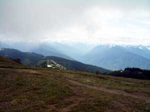
The view to the east - click on the picture for a bigger version that you can pan horizontally

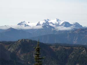
The view to the south with Mount Olympus - click on the picture for a bigger version that you can pan horizontally

Another view to the south with Mount Olympus - click on the picture for a bigger version that you can pan horizontally

Keywords: autumn, high country, obstruction point, panoramas


10/09/07 - First Signs of WInter, Last Signs of Summer

Hurricane Ridge Road had been closed, and we were sure it had been closed for the season. We were wrong. The road is open, so up we went to Klahane Ridge.

This has been an odd year. We missed the usual late summer drying. By September, most of the alpine flowers are past their bloom and rather sere. This year, the lupines were blossoming into autumn, and the hillsides covered with flowers.

The lupines are gone, but even in October, there are a few blossoms - yarrow, Indian paintbrush, and even a few of those violet harebells. There was a bit of ice on the trail, and some slushy segments. The ice freezes under the soil. When you step on it, the soil compacts and the water flows making the ground slippery. Slime ice, we called it, but it dries out in an hour or two and turns into good old fashioned mud.


The last summer flowers, the first winter snow

First bit of snow on Klahane Ridge

Still a bit of Indian paintbrush
We aren't sure of how much snow has fallen in the high country. Obstruction Point Road is closed, but it is a rather twisty, unsealed road, so there may just be ice in one of the dark patches. According to the web camera at Hurricane Ridge there has been a bit of snow at 5200 feet, but it has all melted. Even at Klahane Ridge, on the north face, perhaps at 6000', there are just patches of snow. Still, looking across at the Blue Glacier and Mount Olympus, over 7000', the mountains are looking whiter.

New snow on the Olympic glaciers

Keywords: autumn, flowers, high country, hurricane ridge, klahane ridge, obstruction point, winter


08/31/07 - Obstruction Point

Obstruction Point Road is dusty but open. There is still time to explore the high country. It has been a strange summer though. The lupines are still blooming, even as some foliage starts turning its autumn crimson. As we write this, a light rain is falling in Port Angeles, and we are sure that the unusual wet weather is one reason the high country flowers have been so spectacular and long lasting this year.

Some fall color is coming in

There are still lupines in bloom

Still some snow, even in late August

Keywords: autumn, flowers, high country, obstruction point


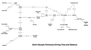
07/26/07 - Driving Time and Distance Map of the North Olympic Peninsula

We get a number of questions from people trying to plan trips to the North Olympic Peninsula and not sure of how far it is from one attraction to another. Olympic National Park is a big park comprising the central part of the peninsula and much of the Pacific Coast. There are no roads through the middle of the park, and there is no long coastal road to follow. This makes planning a trip a bit tricky. Even getting from La Push to Rialto Beach, a distance of perhaps a mile or two along the coast requires driving inland to the bridge at Mora, so the total drive is perhaps 11 miles and takes about 25 minutes. Hurricane Ridge is not very far from the Hoh Ranger Station as the raven flies, but it is several hours drive.

To help the many visitors to the park and surrounding areas, we offer this Kaleberg Driving Time and Distance Map of the North Olympic Peninsula. It is based on the distances as computed by Google Maps, but we have used our own estimated driving times rather than the Google estimates. Google has some peculiar ideas on how fast one can drive on various park roads, and they still have the Hurricane Hill Trail from Whiskey Bend to Hurricane Hill as an automobile road! We're sure that was a trail, even before Google was founded. We've also taken some liberties in defining certain intermediate locations which do not appear on any map. In general, things like Elwha Turnoff and Hoh River Crossing are not marked as such on any other map you might find, but are useful junction points linking roads and turnoffs, just what you want for planning your drive.


Driving Distance Time Map for the North Olympic Peninsula

Keywords: maps, science, port angeles, hurricane ridge, hurricane hill, hoh rain forest, elwha, la push, lake crescent, obstruction point, rialto beach, la push, spruce railroad


10/01/06 - Obstruction Point Autumn

Autumn is a wonderful time to visit the high country, particularly the wilderness at Obstruction Point. The growing season is short up there, so the autumn always feels like borrowed time. It has been dry, and most of the flowers are gone, though the pair lurking amidst the warming rocks in the photo to the left are an exception. There is a lot of color in the alpine foliage, some of it brilliant red.

As usual at this time of year, we are hoping to borrow yet one more trip to Obstruction Point before the winter snows. The high country is haunting and it calls to us.

Keywords: autumn, high country, obstruction point, flowers, winter


09/06/06 - Obstruction Point Update

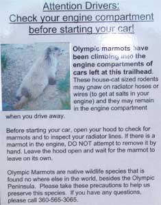
We know that we have mentioned this before, but this time we have a proper photograph of the posted notice warning drivers about marmot invasions of their engine compartments. If the image below is too small, click on it for a larger version. This notice is on the outhouse door at Obstruction Point. Obstruction Point is a great high country hike. We should also note that the outhouse is a great outhouse. The park service has been replacing the old, stinky, rickety outhouses at various trailheads with new, well built, not all that smelly outhouses. So far, they seem to be holding up nicely both in terms of structure and scent.

While the high country is already in late autumn, having raced through its summer, the road is still open, and the trail is still wonderful as you can see in our sampling of photos. We particularly like the fall foliage along this trail. Some of it turns bright red, as you can see to the right. Sometimes the views are so beautiful, it is hard to remember that what one is seeing is real.

Marmot Alert Notice

Keywords: obstruction point, high country, autumn


Hurricane Hill

View From Hurricane Hill

07/19/06 - High Country Update

Obstruction Point Road has just opened, so we decided to take the sharp left at the entrance to the Hurricane Ridge parking lot and see if our Honda could fit on the 1.5 lane road into the high country. We were hoping to take one of our favorite hikes, but the weather was not with us. A bit after PJ's Lake we ran into heavy fog, and were just not up to a harrowing drive on hairpin turns on a narrow road with steep drops and limited visibility. Applying the rule of sour grapes, we rationalized that there was still an awful lot of snow on the trail, as there was along the road, and that we would not have had much of a hike anyway.

Instead, we took a walk at Hurricane Hill, a much more accessible trail. We are pleased to report that the wild roses are in bloom, and the lupines are starting to blossom as well. There were still a few glacier lilies and great fields of dirty sock plant. The Hamper was quite full.

There's a warm weekend coming up, so we'll give Obstruction Point another try in a week or two.

Keywords: high country, obstruction point, hurricane hill, hurricane ridge


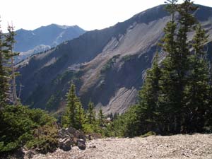
Mount Olympus from Obstruction Point

10/20/05 - Obstruction Point Road Before Winter

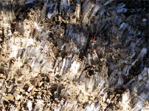
The road to Obstruction Point from Hurricane Ridge is still open.The trails are still clear, and the views are stunning. We didn't go very far, but Mount Olympus and its glaciers dominated our journey, and there was just a bit of left over snow from the previous season. We found these ice crystals (lower left) on the ground, shaded by one of the firs.

In a month or two, the ground will be covered with snow. On our drive, we saw a coyote hustling about, but the marmots have taken cover. There was one other car in the parking lot when we set off, and ours was the only car in the lot when we returned. We were quite relieved when the car started. It's a rough 7.5 mile hike back to Hurricane Ridge

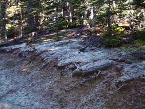
Ice Crystals at Obstruction PointNo Snow On The Trails at Obstruction Point

Keywords: winter, obstruction point, hurricane ridge, marmots, trails


Frost on the trail to Hurricane Hill

10/11/05 - Early Frost in the High Country

There is already frost up in the hills. We were up on the Hurricane Hill Trail this morning, and there it was alongside the trail in the shaded areas. The lingering snows vanished months ago, but now we are getting our first glimpse of winter as the temperatures drop at night.

Obstruction Point Road is still open, but they close it at night. The snow poles are up around the Hurricane Ridge Lodge. This is still autumn, but we are seeing signs of winter, and a mile above sea level winter starts a fair bit earlier than down by the sea.

Keywords: winter, high country, autumn, hurricane hill, hurricane ridge, obstruction point


Golden Marmot

07/15/05 - Obstruction Point Marmots

They're back. We're back. Obstruction Point Road has been open for a few weeks now, and we finally made our way eight miles down the one and a half lane road to some of the most wonderful alpine high country accessible by car in Olympic National Park. We took our usual walk to the rim of the great descent to Moose Lake and promptly turned around and made our way back to the car. The air was thin, most of the snow had melted and all the flowers were out in bloom.

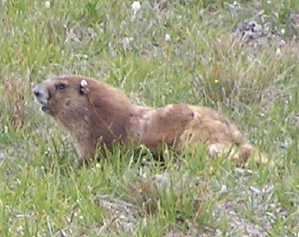
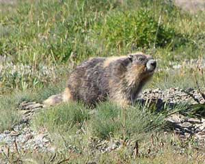
Also, there were marmots, the Olympic golden marmots, who looked well fed and were quite active. We could hear them whistling from some distance, probably warning the other marmots about us human invaders.

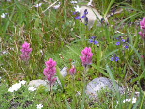
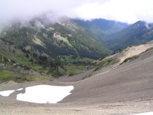
Pink Paintbrush Melting Snow and Lakes in the Mountains Obstruction Point Rock Garden

Keywords: animals, marmots, high country, obstruction point, flowers


Older Golden Marmot

08/30/04 - Marmots of Obstruction Point

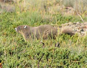
The marmots are out in force. These are just two of the critters we saw out near Obstruction Point. We think the one on the right is a juvenile. He (or she) was sure playful.

If you do plan to get out to Obstruction Point, do so soon. It often gets snowed in by late September, and it is an amazing place.
Young Golden Marmot

Keywords: marmots, high country, obstruction point


The High Country at Obstruction Point - Lupines

07/29/04 - Obstruction Point Open for the Season

The road to Obstruction Point has been open for some time now, but we finally made it up there ourselves. If you don't know Obstruction Point, it is in the high country about 7 or 8 miles down an unpaved from Hurricane Ridge. The road has some scary moments, but the real terror is the left turn you take getting onto it or off of it, since most of the folks on the main road are gawking at the view from Hurricane Ridge.

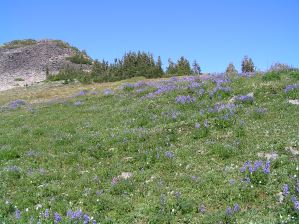
As you can see, the fields are FULL of wildflowers. Most of what you see in the picture to the left are lupines and dirty sock plant with some pink paintbrush for emphasis. Most paintbrush is orange, but you often see the pink variant up in the high country.

There were quite a few people up there at the end of the road. We were walking on the trail and rather openly admiring the scenery when two hikers walked by and, in passing, reminded us, "Don't forget to vote!"

Keywords: high country, obstruction point, flowers, hurricane ridge


Newer Entries