
This is one of the most amazing hikes a day tripper can take in the Olympic National Park. It takes you to the top of the world, out among the great mountains, in the wild alpine country, far past everyday experience. The trail itself is easy to follow, and depending on how far you go, it need not be strenuous, but it takes you to a totally different place - a place of high far mountains and icy glaciers, a place of fragile alpine plants and rocky slopes. There is all that and the high, big sky overhead. There are only so many places where one can get that light headed feeling of being high above it all, on the top of the world, and this is one of those few.
NOTE - Obstruction Point Road is closed during the winter and spring. Call 360 565 3131 to check road conditions at other times of the year.
 Take Race Street from Port Angeles south and
out of
town. Follow the
signs for Hurricane Ridge and head up into the national park. The turn
for
Obstruction Point Road is on the left, just at the start of the
Hurricane
Ridge parking lot. You will probably miss it on the first try. If you
get
to the first parking space, you have gone too far. Turn around as if
you
were heading down, back to town and watch on your right. You will see a
sort of break in the wall and a drop off. This is not where old U Hauls
go to die. This is the road.
Obstruction Point Road is 7.6 miles long and it is not paved, but it is well graded. It is a typical back country 1.5 lane road, so keep your eyes open and watch for the slightly wider points. You can drive it in an ordinary automobile, even a rental without a CDW. The drive will take some skill, some patience, and some tolerance for vertigo. The road often has steep drop offs where the shoulder should be. An encouraging point: if you can make it down the first open descent at the start, you can probably make it all the way.
Take the road to the end. Park in the parking lot. Get out and wait for your knees to stop shaking. Then start your hike.
WARNING: You probably do NOT want to take this drive, or hike, on a rainy, or worse, snowy day. Our comments about road passability are based on a Honda Civic on a dry, fairly sunny day. Fog, rain, sleet and the like can turn this otherwise challenging drive into a nightmare.
 The Lilian Ridge Trail starts right at the
parking
lot with an ascent
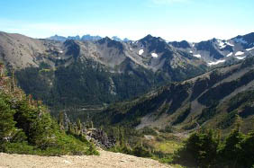
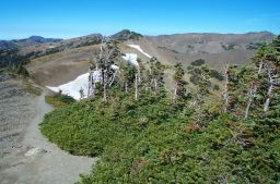
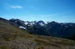
up into open alpine country. The views here, and along most of the
trail,
are spectacular. Mount Olympus seems closer than from Hurricane
Ridge
and offers a slightly different face full of glaciers. The cars in the
lot,
even the SUVs, get pretty small, pretty fast as you ascend. Soon, you
will
get the feeling that you are on the roof of the world.
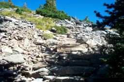
The trail itself is easy to follow. Try to stay on the trail to spare the fragile vegetation. Also, make sure you have taken enough water and are wearing enough sunblock and protective garb. The air is dry and thin here, even if it sometimes seems remarkably gentle. After a bit, the trail takes a right turn and heads down the face of the ridge on a rocky stair case. Watch for the cairn at the top and follow the steps down.
Depending on which way you look, you can see Mount Olympus and its kin, the Puget Sound, Mount Baker in the far distance, or the Strait of San Juan de Fuca. There are mountain lakes and glacial tarns nestled in the valleys below. The thin air makes it seem very quiet, but you may hear the whistle of a nearby marmot. They are often standing sentinel on the rocky slopes. Check the sky for eagles and ravens.
Also, check yourself and know your limits. The wide open space draws one on, but it is a 1200 foot descent to Grand Lake, past stunted trees, glacial cirques and fields of wild flowers. This is the high desert and the weather can change quickly. We usually turn around well before the distant jewel of the lake, but heartier folks head onwards.


|
© Copyright Kaleberg Symbionts 2005 |