The Bogachiel Trail is one of the lesser used trails though it is only a few miles from the popular Hoh Rain Forest. Like the Hoh River Trail, the Bogachiel Trail follows a glacial river upstream through some spectacular rain forest country. It has its ferns and great trees and places to wander out into the sunlight and enjoy the river. Unlike its more popular counterpart, the Bogachiel Trail does not emerge in a glacier strewn meadow, but then again it is nowhere near as crowded. According to the sign at the entrance to the National Park, it ends on Mount Bogachiel, 20 some miles away. We have never gone that far, but we have greatly enjoyed the first five or six miles of it which we have hiked.
Take route 101 south past Forks and watch for the signs for the Bogachiel State Park on your right. Just before the park, take a left on Undie Road. Follow Undie Road, yes that's really its name, to where the pavement ends and keep on going, just drive carefully since the road is rather beaten up here and full of potholes, much like the Brooklyn Queens Expressway in the early 80s. The road ends at a little parking lot. There are signs for the trail.
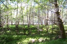
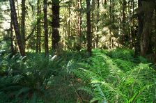
The trail starts with a descent into the jungle - an old fashioned term for rain forest. It levels off among the salal and ferns and roughly follows the route of the river. There are a number of streams to cross, most rather shallow and easy to get over. You are in the National Forest here and the trail is almost always muddy, which makes it much more tiring than its level nature would lead you to expect. About two miles in you head uphill and enter the National Park, and the trail is usually drier here, but not always. Watch out for the neat baby rivers that actually run along the trail.
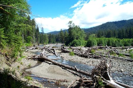
Follow the trail through the spectacular forest and watch for signs of elk and bear. We saw a dozen elk one spring, which is usually when they are about, and we've seen fresh bear tracks. In an hour or less, you will emerge, half crazed with mud fatigue, at a campground along the river. From here, the trail follows the river, going up and down along the high banks until you get to a magnificent washout, where the trail collapses down to the river bank. This is a great spot to picnic, swim or explore (see the photo above). There are often eagles, possibly waiting for the weaker members of your party to collapse with exhaustion - so do bury any hikers who have passed on to that National Park in the sky.
If you still have any strength, look for the continuation of the trail and clamber up to high ground and follow the trail inland a bit. There are True Olympic Blackberries of unsurpassed flavor and tenderness along this section, in season. They can provide vital sustenance.You will soon get to Indian Creek, which is about six miles from the trailhead. We are usually so exhausted by this point that we turn around and head back, lest we be too tired to return alive. Remember, those eagles are waiting, so hiker know thyself.
This is a good trail to bring a rope, since some of the river bank scrambles can be a bit challenging.
Bring extra socks.
You can cross streams more easily, if you throw rocks into them to make stepping stones.
Bogachiel (BOH-gah-sheel) is an Indian word meaning "muddy waters", perhaps a reference to the trail itself, since the river is clear and fast flowing
We have not hiked this trail at the height of the wasp season, in mid to late August. However, if this trail is anything like the Hoh River Trail at this time, be very, very careful to avoid wasps nests hanging over or near the trail - they are not marked here, as they are at the Hoh. Allergic hikers should bring an epi-pen.


© Copyright Kaleberg Symbionts 2002