Morse Creek Trail
UPDATE: 23 May 2009 - Sad news. The last bit of trail has been paved. The view of the sea is as pretty as ever, but the trail no longer offers a respite for tired feet and the footworn. It was nice while it lasted.
The Morse Creek Trail is just east of Port Angeles, so it is not as
wild as many of the national park trails. Still, it is easy to get to
and an easy wander along the Strait of San Juan de Fuca. Since it is so
close to town it has a coterie of regulars who come to enjoy the strait
and the views. You can see the Ediz Spit, Striped Peak, Victoria, and
on clear days, Mount Baker in the distance.
How to Get There
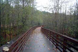
The parking lot at the trail head is visible on Route 101 a bit east of Port Angeles. The highway dips in a deep U where it crosses the creek. The parking lot is visible north of the road. Just pull in and cross the street to the restored railroad bridge and start the walk. (The bridge was rebuilt by volunteers and they've done a great job!)The Kaleberg Hike
- Morse Creek to Port Angeles - 2 stars - a bit
tame, but great views of the strait
The trail starts with the railroad bridge and the trailhead is, if anything, well marked. This trail is part of the Olympic Discovery Trail and runs east, as well as west, from the parking lot. We always head west, up the ramp and over Morse Creek on the railroad bridge. You'll often see people fishing down by the river.
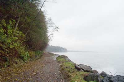
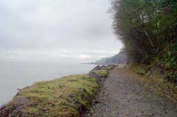
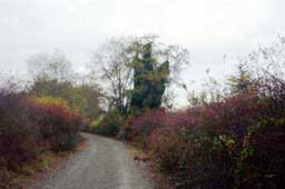
After the bridge, the trail descends for the better part of a mile. You will be in some people's back yards, so give them a break. The trail is lined with wild roses and popcorn plant, but the real payoff comes when you reach the strait. From here, you follow the rocky shore at the base of the bluffs and Port Angeles seems far away.
You can wander for several miles, even into town if you want. You can clamber around on the rocks, but do be careful. When the winds are high, the waves can knock you off the trail or the rocks and into the icy strait. Down there, the beach logs lurk, ready to kill. Ordinary common sense should be sufficient.
Kaleberg Hints
- Mind the weather. You can often see large rocks dislodged here by the power of the sea.
- Bring your dog and a leash. Dogs love it here and there are places for them to romp.
- Bring your bicycle. The trail is completely paved and everywhere easily passable on an ordinary bicycle.
- Drive carefully, especially when turning onto Route 101.
Cars pick up speed at the bottom of the U.


© Copyright Kaleberg Symbionts 2005